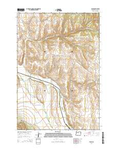
2014 Map of Evans
USGS Topo · Published 2014About this map
Wallowa River and Lostine River converge in the southern reaches of this landscape, defining the drainage patterns for the surrounding high country. The small settlement of Evans sits near the junction of Evans RD and School Flat Ln, serving as a focal point for the rural road network that includes Jim Town Rd and Parsnip Creek RD. This 2014 survey documents the complex water systems of the region, from the natural flow of Spring Br and Straight Whisky Cr to the engineered Westside Ditch that supports local agriculture. Genealogy researchers will find the Lostine Cem and Wallowa Cem clearly marked, alongside family-named landmarks like Allen Canyon and Mclain LN, providing a clear record of the area's established land divisions and rural community structure.
Find a feature on this map
33 named features on this map. Tap any name to fly to it.
Don’t see what you’re looking for? This feature index may not catch every label — zoom into the map to look around manually.
Map Details
Editions of this 2014 Evans Map
This is the sole edition of this map. No revisions or reprints were ever made.
Other maps of this area

1906 · Telocaset
USGS Topo · 1:125,000

1955 · Grangeville
USGS Topo · 1:250,000

1957 · Enterprise
USGS Topo · 1:62,500

1957 · Sled Springs
USGS Topo · 1:62,500

1959 · Grangeville
USGS Topo · 1:250,000

1964 · Akers Butte
USGS Topo · 1:24,000

1964 · Wallowa
USGS Topo · 1:24,000

1965 · Fox Point
USGS Topo · 1:24,000

1982 · Wallowa
USGS Topo · 1:100,000
1984 · Akers Butte
USGS Topo · 1:24,000