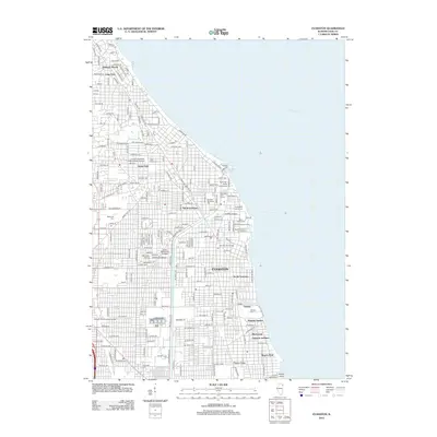
2012 Map of Evanston
USGS Topo · Published 2012About this map
Evanston and its shoreline communities are depicted during a period of dense urban development, where the gridiron street pattern meets the western edge of Lake Michigan. The map details the significant academic and institutional presence in the area, notably the sprawling grounds of Northwestern University and the Loyola University Mallinckrodt Campus. Near the water, the Grosspoint Lighthouse and Dearborn Observatory serve as prominent landmarks, while the N Shore Channel cuts through the landscape to the west, providing a distinct industrial and hydrological boundary between North Evanston and the surrounding neighborhoods. This 2012 survey captures the layout of established residential districts like Hubbard Woods and Rogers Park, alongside numerous cemeteries such as Calvary Cem and Saint Joseph Cem. The presence of the Metra rail line and major corridors like Green Bay Rd illustrates the long-standing transportation network connecting these North Shore suburbs to the city.
Find a feature on this map
190 named features on this map. Tap any name to fly to it.
Don’t see what you’re looking for? This feature index may not catch every label — zoom into the map to look around manually.
Map Details
Editions of this 2012 Evanston Map
This is the sole edition of this map. No revisions or reprints were ever made.
Other maps of this area

1889 · Chicago
USGS Topo · 1:62,500

1891 · Chicago
USGS Topo · 1:62,500

1891 · Riverside
USGS Topo · 1:62,500

1893 · Riverside
USGS Topo · 1:62,500

1899 · Evanston
USGS Topo · 1:62,500

1900 · Chicago
USGS Topo · 1:62,500

1900 · Riverside
USGS Topo · 1:62,500

1900 · Highwood
USGS Topo · 1:62,500

1901 · Riverside
USGS Topo · 1:62,500

1901 · Chicago
USGS Topo · 1:62,500