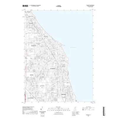
2021 Map of Evanston
USGS Topo · Published 2021About this map
Lake Michigan forms the eastern boundary of this densely settled corridor of the North Shore, where affluent residential communities meet the industrial and academic centers of Cook County. The shoreline is defined by Wilmette Harbor and the lakefront campus of Northwestern University, while the interior landscape is shaped by the North Shore Channel and the Skokie River. This map details the established neighborhoods of Evanston, Wilmette, and Winnetka, alongside the historic settlement at Gross Point. Large institutional tracts, including the Garrett - Evangelical Theological Seminary and expansive burial grounds like Calvary Catholic Cemetery and Memorial Park Cemetery, break up the urban grid. The topography is largely flat, save for subtle elevations like Roger's Ridge and the point at Hayes Point, reflecting the transition from glacial lakebed to coastal bluff.
Find a feature on this map
134 named features on this map. Tap any name to fly to it.
Don’t see what you’re looking for? This feature index may not catch every label — zoom into the map to look around manually.
Map Details
Editions of this 2021 Evanston Map
This is the sole edition of this map. No revisions or reprints were ever made.
Other maps of this area

1889 · Chicago
USGS Topo · 1:62,500

1891 · Chicago
USGS Topo · 1:62,500

1891 · Riverside
USGS Topo · 1:62,500

1893 · Riverside
USGS Topo · 1:62,500

1899 · Evanston
USGS Topo · 1:62,500

1900 · Chicago
USGS Topo · 1:62,500

1900 · Riverside
USGS Topo · 1:62,500

1900 · Highwood
USGS Topo · 1:62,500

1901 · Riverside
USGS Topo · 1:62,500

1901 · Chicago
USGS Topo · 1:62,500