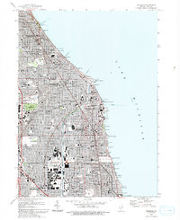
1993 Map of Evanston
USGS Topo · Published 1993About this map
The North Shore communities of Evanston, Wilmette, and Winnetka dominate this detailed 1993 study of the Lake Michigan coastline. The map illustrates a dense landscape of early 20th-century institutions and civic landmarks, ranging from the ornate Bahai Temple overlooking Wilmette Harbor to the sprawling Loyola University campus. The spatial organization of the region is defined by the Chicago and North Western rail line and historic thoroughfares like Sheridan Rd and Green Bay Rd, which historically guided the suburban expansion north of Chicago.
Find a feature on this map
84 named features on this map. Tap any name to fly to it.
Don’t see what you’re looking for? This feature index may not catch every label — zoom into the map to look around manually.
Map Details
Editions of this 1993 Evanston Map
This is the sole edition of this map. No revisions or reprints were ever made.
Other maps of this area

1889 · Chicago
USGS Topo · 1:62,500

1891 · Chicago
USGS Topo · 1:62,500

1891 · Riverside
USGS Topo · 1:62,500

1893 · Riverside
USGS Topo · 1:62,500

1899 · Evanston
USGS Topo · 1:62,500

1900 · Chicago
USGS Topo · 1:62,500

1900 · Riverside
USGS Topo · 1:62,500

1900 · Highwood
USGS Topo · 1:62,500

1901 · Riverside
USGS Topo · 1:62,500

1901 · Chicago
USGS Topo · 1:62,500