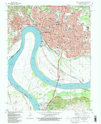
1981 Map of Evansville South
USGS Topo · Published 1982About this map
The Ohio River dictates the geography of this border region, carving a deep loop between Indiana and Kentucky. On the northern bank, Evansville appears as a developed urban center, marked by a dense network of institutions such as Lockyear College, Welborn Baptist Hospital, and the Civic Center. The city's northern and eastern reaches are defined by significant green spaces and civic landmarks, including Bosse Field and the sprawling Oak Hill Cemetery.
Find a feature on this map
76 named features on this map. Tap any name to fly to it.
Don’t see what you’re looking for? This feature index may not catch every label — zoom into the map to look around manually.
Map Details
Editions of this 1981 Evansville South Map
2 editions found
Other maps of this area

1901 · Haubstadt
USGS Topo · 1:62,500

1902 · Ditney
USGS Topo · 1:125,000

1902 · Boonville
USGS Topo · 1:62,500

1903 · Haubstadt
USGS Topo · 1:62,500

1903 · Patoka
USGS Topo · 1:125,000

1905 · Newburg
USGS Topo · 1:62,500

1914 · Henderson
USGS Topo · 1:48,000

1916 · Henderson
USGS Topo · 1:62,500

1951 · Spottsville
USGS Topo · 1:24,000

1952 · Evansville
USGS Topo · 1:24,000