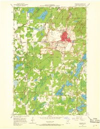
1951 Map of Eveleth
USGS Topo · Published 1968About this map
Industrial iron mining defines the landscape of the Mesabi Range in the early 1950s, where massive open pits like the Virginia Mine and Adams Pit dominate the terrain north of Eveleth. The complex operations of the Duluth Missabe and Iron Range railroad weave through the pits and around extensive tailings piles, connecting the heavy industry to the town centers. Beyond the industrial core, smaller settlements such as Leonidas and Iron Junction serve as residential anchors for the mining workforce.
Find a feature on this map
74 named features on this map. Tap any name to fly to it.
Don’t see what you’re looking for? This feature index may not catch every label — zoom into the map to look around manually.
Map Details
Editions of this 1951 Eveleth Map
5 editions found
Other maps of this area

1950 · Mc Kinley
USGS Topo · 1:24,000

1951 · Mc Kinley
USGS Topo · 1:24,000

1951 · Gilbert
USGS Topo · 1:24,000

1951 · Eveleth
USGS Topo · 1:24,000

1951 · Virginia
USGS Topo · 1:24,000

1951 · Kinney
USGS Topo · 1:24,000

1951 · Kirk
USGS Topo · 1:24,000

1951 · Central Lakes
USGS Topo · 1:24,000

1951 · Zim
USGS Topo · 1:24,000

1951 · Casco
USGS Topo · 1:24,000