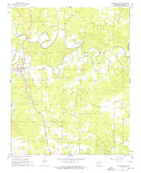
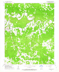
1961 Map of Evening Shade
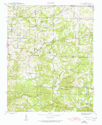
USGS Topo · Published 1977About this map
Evening Shade serves as the focal point of this Sharp County landscape, situated where Piney Fork winds through the Ozark foothills. The settlement is defined by its proximity to the water and the narrow ridge of The Backbone, which rises sharply to the north. This mid-century record captures the rural character of the area before modern expansion, highlighting a network of family cemeteries and country churches that anchor the local geography.
Find a feature on this map
56 named features on this map. Tap any name to fly to it.
Don’t see what you’re looking for? This feature index may not catch every label — zoom into the map to look around manually.
Map Details
Editions of this 1961 Evening Shade Map
2 editions found
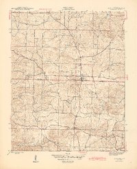
Other maps of this area

1890 · Batesville
USGS Topo · 1:125,000

1891 · Batesville
USGS Topo · 1:125,000

1932 · Strawberry
USGS Topo · 1:62,500

1935 · Strawberry
USGS Topo · 1:62,500

1941 · Strawberry
USGS Topo · 1:62,500
1943 · Sandtown
USGS Topo · 1:24,000
1943 · Cave City
USGS Topo · 1:31,680

1953 · Memphis
USGS Topo · 1:250,000

1956 · Memphis
USGS Topo · 1:250,000

1957 · Poplar Bluff
USGS Topo · 1:250,000