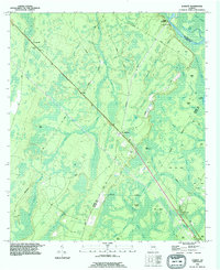
1993 Map of Everett
USGS Topo · Published 1995About this map
Mt Pleasant sits at the heart of this coastal Georgia landscape, where the long diagonal of the Southern Railway cuts through a complex network of wetlands and wooded islands. This region, updated in the early 1990s, reflects a deep-rooted rural infrastructure defined by local landmarks like the Union Church and Bull Church. The terrain is dominated by vast drainage systems including Buffalo Swamp and Bear Island Swamp, which isolate various named hammocks and islands such as Tob Hammock and Briar Island. The presence of the Lookout Tower near Grangerville and a Claypit near the western edge suggests a landscape shaped by both forest management and small-scale resource extraction. To the northeast, the Altamaha River provides a natural boundary, where Sansavilla Bluff overlooks a series of river-fed basins like Campbell Lake and Barker Lake.
Find a feature on this map
55 named features on this map. Tap any name to fly to it.
Don’t see what you’re looking for? This feature index may not catch every label — zoom into the map to look around manually.
Map Details
Editions of this 1993 Everett Map
This is the sole edition of this map. No revisions or reprints were ever made.
Other maps of this area

1918 · Jesup
USGS Topo · 1:62,500

1918 · Hortense
USGS Topo · 1:62,500

1918 · Everett City
USGS Topo · 1:62,500

1920 · Everett City
USGS Topo · 1:62,500

1943 · Ludowici
USGS Topo · 1:62,500

1943 · Jesup
USGS Topo · 1:62,500

1944 · Everett City
USGS Topo · 1:62,500

1944 · Hortense
USGS Topo · 1:62,500

1946 · Brunswick
USGS Topo · 1:250,000

1948 · Brunswick
USGS Topo · 1:250,000