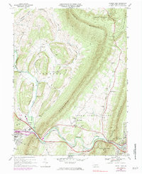
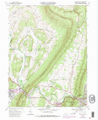
1968 Map of Everett West
USGS Topo · Published 1983About this map
Dunning Mountain and Evitts Mountain frame the agricultural and transport corridors of central Bedford County in this late 1960s study, with revisions through the early 1970s. The landscape is defined by the tight passage at The Narrows, where the Raystown Branch Juniata River cuts through the ridges alongside the Pennsylvania Turnpike and the Penn Central railroad. This map captures the region's transition, showing the expansion of settlements like Chalybeate and Penn Wood near the county seat, while maintaining the rural character of valley communities such as Imlertown and Lutzville. Local landmarks including Memorial Hospital and various rural sanctuaries like Messiah Ch provide essential touchpoints for genealogical research. The juxtaposition of heavy infrastructure, like the sprawling turnpike, against the protected terrain of State Game Lands No 73 highlights the balance of industry and conservation in the Pennsylvania ridge-and-valley province.
Find a feature on this map
58 named features on this map. Tap any name to fly to it.
Don’t see what you’re looking for? This feature index may not catch every label — zoom into the map to look around manually.
Map Details
Editions of this 1968 Everett West Map
5 editions found
Other maps of this area

1900 · Everett
USGS Topo · 1:62,500

1902 · Everett
USGS Topo · 1:62,500

1908 · Bedford
USGS Topo · 1:62,500

1910 · Bedford
USGS Topo · 1:62,500

1927 · Clearville
USGS Topo · 1:48,000

1927 · Hyndman
USGS Topo · 1:62,500

1931 · Clearville
USGS Topo · 1:62,500

1931 · Hyndman
USGS Topo · 1:62,500

1944 · Hyndman
USGS Topo · 1:62,500

1944 · Clearville
USGS Topo · 1:62,500