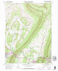
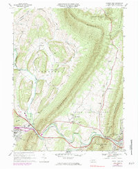
1968 Map of Everett West
USGS Topo · Published 1987About this map
The Narrows serves as a natural gateway where the Raystown Branch Juniata River and the Pennsylvania RR squeeze between the steep slopes of Evitts Mountain and Sifeler Mountain. This topographical bottleneck dictates the layout of the region's infrastructure, funneling transportation routes toward the borough of Bedford and the village of Chalybeate. To the north, the landscape opens into Dunning Cove and the high ridges of Price Ridge and Pleasant Ridge, where small communities like Imlertown and Oppenheimer are established along the winding course of Dunning Creek.
Find a feature on this map
59 named features on this map. Tap any name to fly to it.
Don’t see what you’re looking for? This feature index may not catch every label — zoom into the map to look around manually.
Map Details
Editions of this 1968 Everett West Map
5 editions found
Other maps of this area

1900 · Everett
USGS Topo · 1:62,500

1902 · Everett
USGS Topo · 1:62,500

1908 · Bedford
USGS Topo · 1:62,500

1910 · Bedford
USGS Topo · 1:62,500

1927 · Clearville
USGS Topo · 1:48,000

1927 · Hyndman
USGS Topo · 1:62,500

1931 · Clearville
USGS Topo · 1:62,500

1931 · Hyndman
USGS Topo · 1:62,500

1944 · Hyndman
USGS Topo · 1:62,500

1944 · Clearville
USGS Topo · 1:62,500