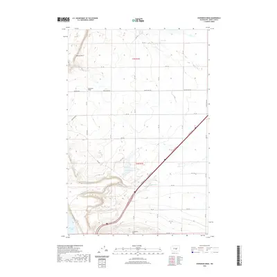
2020 Map of Evergreen Ridge
USGS Topo · Published 2020About this map
Frenchman Hills dominate the southern landscape of this Grant County corridor, where the arid terrain transitions toward the Columbia River. The map illustrates a complex network of rural infrastructure including Baseline West Rd and Beverly Burke Rd, serving the vast agricultural and open lands of the Columbia Basin. To the west, the dramatic drop-off at Babcock Bench overlooks the waters of Wanapum Lake, a significant reservoir on the river. The presence of smaller water bodies such as Cree Lake, Cabin Lake, and the Caliche Lakes highlights the importance of water management and natural catchments in this high-desert environment. Geologic features like Frenchman Springs and Evergreen Ridge further define the local topography, which is bisected by the Old Vantage Hwy and modern interstate transit routes.
Find a feature on this map
29 named features on this map. Tap any name to fly to it.
Don’t see what you’re looking for? This feature index may not catch every label — zoom into the map to look around manually.
Map Details
Editions of this 2020 Evergreen Ridge Map
This is the sole edition of this map. No revisions or reprints were ever made.
Other maps of this area

1909 · Quincy
USGS Topo · 1:62,500

1910 · Quincy
USGS Topo · 1:62,500

1912 · Beverly
USGS Topo · 1:62,500

1920 · Colockum Pass
USGS Topo · 1:125,000

1922 · Colockum Pass
USGS Topo · 1:125,000

1939 · Boylston
USGS Topo · 1:48,000

1943 · Boylston
USGS Topo · 1:62,500

1950 · Yakima
USGS Topo · 1:250,000

1953 · Ginkgo
USGS Topo · 1:24,000
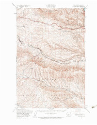
1953 · Boylston
USGS Topo · 1:62,500