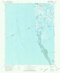
1968 Map of Ewell
USGS Topo · Published 1972About this map
Smith Island anchors this mid-century survey of the unique marshland archipelago straddling the Maryland Virginia state line. The isolated communities of Ewell, Rhodes Point, and Tylerton are meticulously documented, revealing a landscape defined by an intricate network of waterways such as The Canal, Tyler Ditch, and Shanks Creek. This specific era captures the islands before significant modern shoreline changes, showing the placement of Calvary Ch and local Cem sites that serve as vital touchstones for family historians.
Find a feature on this map
61 named features on this map. Tap any name to fly to it.
Don’t see what you’re looking for? This feature index may not catch every label — zoom into the map to look around manually.
Map Details
Editions of this 1968 Ewell Map
2 editions found
Other maps of this area

1898 · St. Marys
USGS Topo · 1:125,000

1903 · Crisfield
USGS Topo · 1:62,500

1903 · Bloodsworth Island
USGS Topo · 1:62,500

1903 · Deal Island
USGS Topo · 1:62,500

1906 · St. Marys
USGS Topo · 1:125,000

1917 · Ewell
USGS Topo · 1:62,500

1920 · Crisfield
USGS Topo · 1:62,500

1942 · Terrapin Sand Point
USGS Topo · 1:24,000

1942 · Kedges Straits
USGS Topo · 1:24,000

1942 · Ewell
USGS Topo · 1:24,000