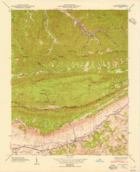
1949 Map of Ewing
USGS Topo · Published 1949About this map
Cumberland Mountain dominates this landscape, serving as the dramatic high-ground boundary between Kentucky and Virginia during the late 1940s. The region is defined by the sharp transition from the industrial and mining-focused north, centered around Alva, to the agricultural valley floor near Ewing. Along the southern base of the ridge, the Louisville and Nashville railroad tracks follow the low ground of Poor Valley, connecting small settlements and family hubs. The map reveals a deeply rooted community structure, evidenced by the concentration of family burial grounds like Brittain Cem and Gibson Cem, and essential local infrastructure including Cowan Mill and Kesterson Mill. Notable landmarks such as the White Rocks and Sand Cave within the Cumberland Gap National Historical Park highlight the area's significance as a historic passage through the Appalachians.
Find a feature on this map
78 named features on this map. Tap any name to fly to it.
Don’t see what you’re looking for? This feature index may not catch every label — zoom into the map to look around manually.
Map Details
Editions of this 1949 Ewing Map
2 editions found
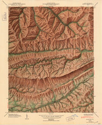
Other maps of this area

1886 · Cumberland Gap
USGS Topo · 1:125,000

1887 · Jonesville
USGS Topo · 1:125,000

1888 · Cumberland Gap
USGS Topo · 1:125,000

1891 · Cumberland Gap
USGS Topo · 1:125,000

1891 · Jonesville
USGS Topo · 1:125,000

1903 · Harlan
USGS Topo · 1:48,000

1903 · Pineville
USGS Topo · 1:48,000

1903 · Middlesboro
USGS Topo · 1:48,000

1916 · Harlan
USGS Topo · 1:48,000

1919 · Harlan
USGS Topo · 1:62,500