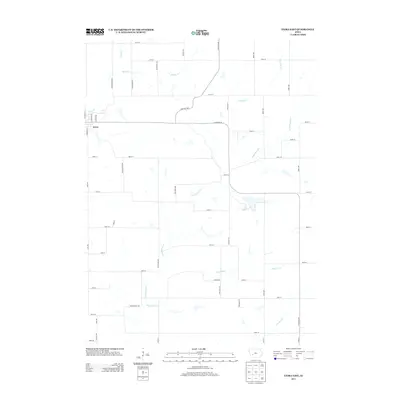
2013 Map of Exira East
USGS Topo · Published 2013About this map
The settlement of Exira sits on the western edge of this landscape, serving as a focal point for a predominantly agricultural region defined by its complex drainage network. The terrain is etched by several prominent waterways, most notably Troublesome Cr, which winds through the central portion of the quadrangle. Other tributaries including Honey Cr, Davids Cr, and Fourmile Cr segment the land, influencing the layout of the local road grid. The map reveals a highly structured section-line road system, including thoroughfares like Littlefield Dr and Ames Rd, which connect the scattered farmsteads of Audubon County. This 2013 survey provides a clear view of the modern rural infrastructure, showing the persistence of the traditional land divisions as they interact with natural features like Pleasant Cr and Crooked Cr.
Find a feature on this map
46 named features on this map. Tap any name to fly to it.
Don’t see what you’re looking for? This feature index may not catch every label — zoom into the map to look around manually.
Map Details
Editions of this 2013 Exira East Map
This is the sole edition of this map. No revisions or reprints were ever made.
Other maps of this area

1954 · Omaha
USGS Topo · 1:250,000

1957 · Omaha
USGS Topo · 1:250,000

1957 · Audubon
USGS Topo · 1:62,500

1958 · Omaha
USGS Topo · 1:250,000

1971 · Adair South
USGS Topo · 1:24,000

1971 · Anita
USGS Topo · 1:24,000

1971 · Wiota
USGS Topo · 1:24,000

1971 · North Branch
USGS Topo · 1:24,000
1971 · Adair North
USGS Topo · 1:24,000
1983 · Exira West
USGS Topo · 1:24,000