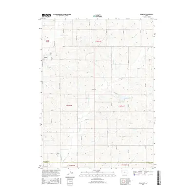
2015 Map of Exira East
USGS Topo · Published 2015About this map
The settlement of Exira sits at the western edge of this agricultural landscape, where the town's early history is reflected in the surrounding Exira Cem and Holy Trinity Cem. Located in southern Audubon County, the area is defined by a dendritic network of streams, including the winding Troublesome Cr and Honey Cr, which shaped the early township and range boundaries. The rural character is further detailed by established burial grounds like Grove Cem to the east and Bowen Cem near the southern border with Cass County.
Find a feature on this map
50 named features on this map. Tap any name to fly to it.
Don’t see what you’re looking for? This feature index may not catch every label — zoom into the map to look around manually.
Map Details
Editions of this 2015 Exira East Map
This is the sole edition of this map. No revisions or reprints were ever made.
Other maps of this area

1954 · Omaha
USGS Topo · 1:250,000

1957 · Omaha
USGS Topo · 1:250,000

1957 · Audubon
USGS Topo · 1:62,500

1958 · Omaha
USGS Topo · 1:250,000

1971 · Adair South
USGS Topo · 1:24,000

1971 · Anita
USGS Topo · 1:24,000

1971 · Wiota
USGS Topo · 1:24,000

1971 · North Branch
USGS Topo · 1:24,000
1971 · Adair North
USGS Topo · 1:24,000
1983 · Exira West
USGS Topo · 1:24,000