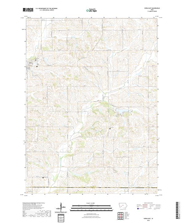
2022 Map of Exira East
USGS Topo · Published 2022About this map
The town of Exira anchors the northwestern corner of this Audubon County landscape, where the local terrain is defined by a dendritic network of streams. Small family and community burial grounds, including Exira Cem, Grove Cem, and Bowen Cem, are scattered across the township lines of T79N, T78N, and T77N. The drainage pattern is particularly dense here, with Troublesome Creek winding through the center of the quadrangle, joined by secondary waterways like Honey Creek, Davids Creek, and Fourmile Creek. A structured grid of secondary roads such as Mockingbird Ave and Pheasant Ave provides access to the agricultural plots that dominate the region. The southern edge of the survey marks the transition from Audubon County into Cass County, centered around the headwaters of Pleasant Creek and Crooked Creek.
Find a feature on this map
50 named features on this map. Tap any name to fly to it.
Don’t see what you’re looking for? This feature index may not catch every label — zoom into the map to look around manually.
Map Details
Editions of this 2022 Exira East Map
This is the sole edition of this map. No revisions or reprints were ever made.
Other maps of this area

1954 · Omaha
USGS Topo · 1:250,000

1957 · Omaha
USGS Topo · 1:250,000

1957 · Audubon
USGS Topo · 1:62,500

1958 · Omaha
USGS Topo · 1:250,000

1971 · Adair South
USGS Topo · 1:24,000

1971 · Anita
USGS Topo · 1:24,000

1971 · Wiota
USGS Topo · 1:24,000

1971 · North Branch
USGS Topo · 1:24,000
1971 · Adair North
USGS Topo · 1:24,000
1983 · Exira West
USGS Topo · 1:24,000