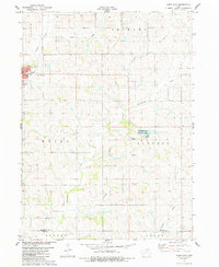
1983 Map of Exira East
USGS Topo · Published 1984About this map
The town of Exira serves as the focal point of this western Iowa landscape, situated where the terrain begins to ripple with the drainages of Davids Creek and Honey Creek. The map illustrates a well-ordered rural grid typical of the late twentieth-century Midwest, transitioning from the residential streets of the town into the rolling farmland of Greeley and Audubon townships. Significant local landmarks include the High Sch and several key burial grounds that offer valuable data for genealogists, such as Holy Trinity Cem, Grove Cem, and Bowen Cem.
Find a feature on this map
23 named features on this map. Tap any name to fly to it.
Don’t see what you’re looking for? This feature index may not catch every label — zoom into the map to look around manually.
Map Details
Editions of this 1983 Exira East Map
This is the sole edition of this map. No revisions or reprints were ever made.
Other maps of this area

1954 · Omaha
USGS Topo · 1:250,000

1957 · Omaha
USGS Topo · 1:250,000

1957 · Audubon
USGS Topo · 1:62,500

1958 · Omaha
USGS Topo · 1:250,000

1971 · Adair South
USGS Topo · 1:24,000

1971 · Anita
USGS Topo · 1:24,000

1971 · Wiota
USGS Topo · 1:24,000

1971 · North Branch
USGS Topo · 1:24,000
1971 · Adair North
USGS Topo · 1:24,000
1983 · Exira West
USGS Topo · 1:24,000