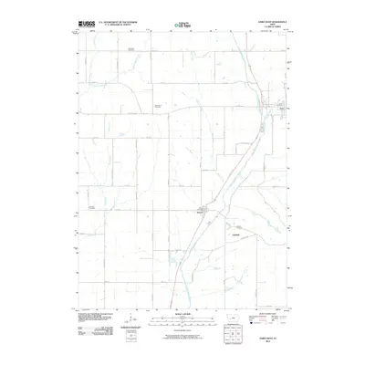
2010 Map of Exira West
USGS Topo · Published 2010About this map
The East Nishnabotna River serves as the central artery for this portion of Audubon County, flowing past the communities of Exira, Brayton, and Oakfield. This 2010 survey illustrates the structured agricultural grid characteristic of western Iowa, where a network of gravel and paved roads like Falcon Ave and Lark Ave segment the landscape. Small tributaries including Buck Creek, Sifford Creek, and Little Indian Creek feed into the main river valley, creating the subtle drainage patterns that define the local topography.
Find a feature on this map
37 named features on this map. Tap any name to fly to it.
Don’t see what you’re looking for? This feature index may not catch every label — zoom into the map to look around manually.
Map Details
Editions of this 2010 Exira West Map
This is the sole edition of this map. No revisions or reprints were ever made.
Other maps of this area

1954 · Omaha
USGS Topo · 1:250,000

1957 · Omaha
USGS Topo · 1:250,000

1957 · Audubon
USGS Topo · 1:62,500

1958 · Omaha
USGS Topo · 1:250,000

1971 · Anita
USGS Topo · 1:24,000

1971 · Wiota
USGS Topo · 1:24,000

1971 · Atlantic
USGS Topo · 1:24,000

1978 · Elk Horn
USGS Topo · 1:24,000

1978 · Kimballton
USGS Topo · 1:24,000
1980 · Harlan
USGS Topo · 1:100,000