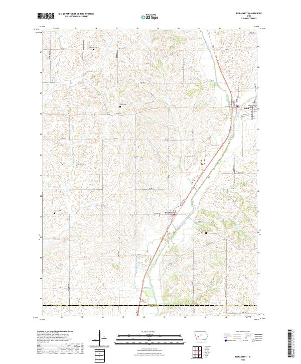
2022 Map of Exira West
USGS Topo · Published 2022About this map
The East Nishnabotna River carves a path through the rolling agricultural landscape of Audubon and Cass Counties, defining the drainage patterns for numerous local tributaries like Little Indian Cr and Davids Cr. The settlement of Exira serves as a primary hub in the northeast corner of the sheet, while the town of Brayton is situated further south along the river valley. The region's history is anchored by its rural burial grounds, including Adventist Cem, Saint Johns Cem, Oak Hill Cem, and Oakfield Cem, providing significant points of interest for genealogical research. The T-Bone Trl follows a linear path through the valley, highlighting the transformation of former transportation corridors into modern recreational routes. This survey reflects the enduring grid of section-line roads such as Goldfinch Ave and 300th St that partition the landscape between the river's winding course.
Find a feature on this map
44 named features on this map. Tap any name to fly to it.
Don’t see what you’re looking for? This feature index may not catch every label — zoom into the map to look around manually.
Map Details
Editions of this 2022 Exira West Map
This is the sole edition of this map. No revisions or reprints were ever made.
Other maps of this area

1954 · Omaha
USGS Topo · 1:250,000

1957 · Omaha
USGS Topo · 1:250,000

1957 · Audubon
USGS Topo · 1:62,500

1958 · Omaha
USGS Topo · 1:250,000

1971 · Anita
USGS Topo · 1:24,000

1971 · Wiota
USGS Topo · 1:24,000

1971 · Atlantic
USGS Topo · 1:24,000

1978 · Elk Horn
USGS Topo · 1:24,000

1978 · Kimballton
USGS Topo · 1:24,000
1980 · Harlan
USGS Topo · 1:100,000