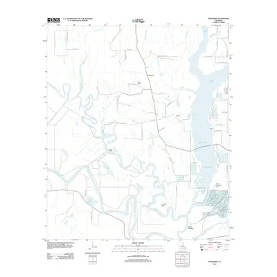
2012 Map of Extension
USGS Topo · Published 2012About this map
Jones Landing and the rural community of Extension anchor this survey of the low-lying wetlands and prairies along the Franklin Parish border. The landscape is defined by the winding course of the Ouachita River and the complex hydrology of the Boeuf River, which creates distinctive landforms like Rabbit Island and Cocklebur Island. Large water bodies including Willis Lake and Turkey Creek Lake dominate the eastern half of the map, reflecting a region deeply tied to its riverine environment. Local genealogy and land use are visible through features like Carrway Cem and King Cem, alongside family-named roads such as Alex Washington Rd and John Dailey Rd. The map also captures specialized infrastructure like the Turkey Creek Lake Airport and the Turkey Creek Dam, showing how the modern era has managed this water-rich territory of the Boeuf Prairie.
Find a feature on this map
66 named features on this map. Tap any name to fly to it.
Don’t see what you’re looking for? This feature index may not catch every label — zoom into the map to look around manually.
Map Details
Editions of this 2012 Extension Map
This is the sole edition of this map. No revisions or reprints were ever made.
Other maps of this area

1935 · Winnsboro
USGS Topo · 1:62,500

1939 · Fort Necessity
USGS Topo · 1:62,500

1941 · Sicily Island
USGS Topo · 1:62,500

1941 · Harrisonburg
USGS Topo · 1:62,500

1953 · Natchez
USGS Topo · 1:250,000

1955 · Jackson
USGS Topo · 1:250,000

1956 · Natchez
USGS Topo · 1:250,000

1957 · Sicily Island
USGS Topo · 1:62,500

1958 · Winnsboro
USGS Topo · 1:62,500

1958 · Fort Necessity
USGS Topo · 1:62,500