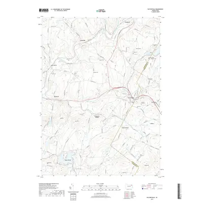
2019 Map of Factoryville
USGS Topo · Published 2019About this map
Keystone College serves as a cultural anchor in this corner of Pennsylvania, situated where the South Branch Tunkhannock Creek winds through the hills between Factoryville and La Plume. The landscape is defined by its numerous small burial grounds and family plots, such as the Seamans Family Cem and Radle Family Cem, which offer significant value for genealogical research. The region's geography is characterized by high ridges like Tunnel Hill and Bunker Hill, overlooking substantial water bodies and wetlands including Lake Winola and the Stantontown Swamp. The settlement pattern reflects a history of small rural communities connected by winding valley roads, with Nicholson to the north and Dalton to the southeast. Traces of local development are evident in named hills and hollows like Carpenter Hollow and Lake Sheridan Hill, indicating a long-standing relationship between the resident families and the varied terrain of the Tunkhannock Creek watershed.
Find a feature on this map
126 named features on this map. Tap any name to fly to it.
Don’t see what you’re looking for? This feature index may not catch every label — zoom into the map to look around manually.
Map Details
Editions of this 2019 Factoryville Map
This is the sole edition of this map. No revisions or reprints were ever made.
Other maps of this area

1889 · Scranton
USGS Topo · 1:62,500

1891 · Scranton
USGS Topo · 1:62,500

1892 · Dundaff
USGS Topo · 1:62,500

1893 · Pittston
USGS Topo · 1:62,500

1893 · Scranton
USGS Topo · 1:62,500

1943 · Scranton
USGS Topo · 1:125,000

1946 · Tunkhannock
USGS Topo · 1:62,500

1946 · Dalton
USGS Topo · 1:24,000

1946 · Ransom
USGS Topo · 1:24,000

1946 · Factoryville
USGS Topo · 1:24,000