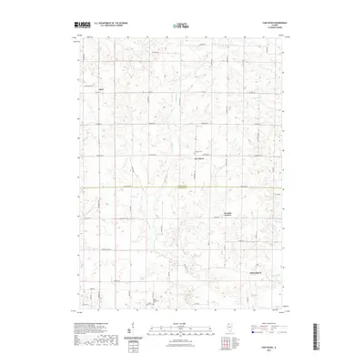
2021 Map of Fair Haven
USGS Topo · Published 2021About this map
Fair Haven serves as a central point of interest in this rural landscape, situated just north of the Carroll Co - Whiteside Co line. The terrain is defined by the winding paths of Little Rock Cr and Rock Cr, which carve through the agricultural tablelands. For genealogists and local historians, the map identifies several significant burial sites, including the Fairhaven Cem near the town center and the Clyde Methodist Cem further south.
Find a feature on this map
46 named features on this map. Tap any name to fly to it.
Don’t see what you’re looking for? This feature index may not catch every label — zoom into the map to look around manually.
Map Details
Editions of this 2021 Fair Haven Map
This is the sole edition of this map. No revisions or reprints were ever made.
Other maps of this area

1891 · Clinton
USGS Topo · 1:62,500

1892 · Savanna
USGS Topo · 1:62,500

1894 · Clinton
USGS Topo · 1:62,500

1899 · Clinton
USGS Topo · 1:125,000

1934 · Morrison
USGS Topo · 1:48,000

1940 · Morrison
USGS Topo · 1:62,500

1942 · Mt Carroll
USGS Topo · 1:62,500

1944 · Mt Carroll
USGS Topo · 1:62,500

1952 · Clinton
USGS Topo · 1:62,500

1952 · Savanna
USGS Topo · 1:62,500