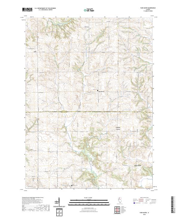
2024 Map of Fair Haven
USGS Topo · Published 2024About this map
Little Rock Creek winds southward through the center of this rural landscape, serving as a primary drainage for the agricultural lands spanning the Carroll County and Whiteside County border. The map illustrates a pattern of small, dispersed settlements including Fair Haven, White Pigeon, and Franklin Corners, which are connected by a grid-like network of secondary roads and local routes such as Co Hwy 8 and Spring Valley Rd.
Find a feature on this map
44 named features on this map. Tap any name to fly to it.
Don’t see what you’re looking for? This feature index may not catch every label — zoom into the map to look around manually.
Map Details
Editions of this 2024 Fair Haven Map
This is the sole edition of this map. No revisions or reprints were ever made.
Other maps of this area

1891 · Clinton
USGS Topo · 1:62,500

1892 · Savanna
USGS Topo · 1:62,500

1894 · Clinton
USGS Topo · 1:62,500

1899 · Clinton
USGS Topo · 1:125,000

1934 · Morrison
USGS Topo · 1:48,000

1940 · Morrison
USGS Topo · 1:62,500

1942 · Mt Carroll
USGS Topo · 1:62,500

1944 · Mt Carroll
USGS Topo · 1:62,500

1952 · Clinton
USGS Topo · 1:62,500

1952 · Savanna
USGS Topo · 1:62,500