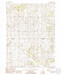
1985 Map of Fair Haven
USGS Topo · Published 1985About this map
The agricultural landscape of northwest Illinois is documented in this mid-1980s study of Fair Haven and the surrounding townships. Situated on the border of Carroll and Whiteside Counties, the area is defined by a dense network of country roads and small unincorporated settlements like White Pigeon and Franklin Corners. The drainage patterns of the region are clearly visible, with Little Rock Creek and Rock Creek winding through the fields toward the south.
Find a feature on this map
15 named features on this map. Tap any name to fly to it.
Don’t see what you’re looking for? This feature index may not catch every label — zoom into the map to look around manually.
Map Details
Editions of this 1985 Fair Haven Map
This is the sole edition of this map. No revisions or reprints were ever made.
Other maps of this area

1891 · Clinton
USGS Topo · 1:62,500

1892 · Savanna
USGS Topo · 1:62,500

1894 · Clinton
USGS Topo · 1:62,500

1899 · Clinton
USGS Topo · 1:125,000

1934 · Morrison
USGS Topo · 1:48,000

1940 · Morrison
USGS Topo · 1:62,500

1942 · Mt Carroll
USGS Topo · 1:62,500

1944 · Mt Carroll
USGS Topo · 1:62,500

1952 · Clinton
USGS Topo · 1:62,500

1952 · Savanna
USGS Topo · 1:62,500