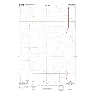
2010 Map of Fair Oaks
USGS Topo · Published 2010About this map
Agricultural patterns and a highly engineered drainage system define this Jasper County landscape near the dawn of the twenty-first century. The settlement of Fair Oaks serves as the primary hub, while the smaller community of Pembroke sits further north. The terrain is characterized by an extensive network of man-made channels designed to reclaim and manage the land, including the Beaver Lake Ditch, Moffett Ditch, and Mud Lake Ditch. These ditches, many bearing family names like the Elijah Ditch and Deardurff Ditch, follow the rigid section lines of the rural road grid. Curtis Creek provides a rare natural contrast to the rectilinear waterways. This era shows the region as a mature farming landscape, where the legacy of early drainage projects remains the fundamental infrastructure for modern land use and transportation.
Find a feature on this map
33 named features on this map. Tap any name to fly to it.
Don’t see what you’re looking for? This feature index may not catch every label — zoom into the map to look around manually.
Map Details
Editions of this 2010 Fair Oaks Map
This is the sole edition of this map. No revisions or reprints were ever made.
Other maps of this area

1953 · Chicago
USGS Topo · 1:250,000

1953 · Danville
USGS Topo · 1:250,000

1955 · Danville
USGS Topo · 1:250,000

1956 · Danville
USGS Topo · 1:250,000

1957 · Chicago
USGS Topo · 1:250,000

1957 · DeMotte
USGS Topo · 1:24,000

1959 · Schneider
USGS Topo · 1:24,000

1959 · Shelby
USGS Topo · 1:24,000

1961 · Mount Ayr
USGS Topo · 1:24,000

1961 · Morocco
USGS Topo · 1:24,000