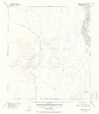
1951 Map of Fairbanks B-1
USGS Topo · Published 1951About this map
Ladd Air Force Base dominates the center of this landscape, encompassing a massive Bombing and Gunnery Range that spans the eastern and southern portions of the quadrangle. The terrain is defined by the braided channels of the Tanana River in the northeast corner and the winding course of Dry Creek as it moves south through the military reservation. In the west-central portion of the base, the Blair Lakes serve as a focal point near an isolated Airstrip. This mid-century survey, based on aerial photography from August 1949, documents the expansive military footprint in the Alaskan interior during the early Cold War era. The topography transitions from the low-lying basin near Flat to the higher elevations marked along the southern Military Reservation Boundary.
Find a feature on this map
11 named features on this map. Tap any name to fly to it.
Don’t see what you’re looking for? This feature index may not catch every label — zoom into the map to look around manually.
Map Details
Editions of this 1951 Fairbanks B-1 Map
2 editions found
Other maps of this area

1949 · Big Delta B-6
USGS Topo · 1:63,360

1949 · Fairbanks C-1
USGS Topo · 1:63,360

1949 · Big Delta C-6
USGS Topo · 1:63,360

1949 · Fairbanks C-2
USGS Topo · 1:63,360

1949 · Big Delta A-6
USGS Topo · 1:63,360

1949 · Fairbanks A-2
USGS Topo · 1:63,360

1949 · Fairbanks A-1
USGS Topo · 1:63,360

1950 · Fairbanks
USGS Topo · 1:250,000

1950 · Big Delta
USGS Topo · 1:250,000

1950 · Fairbanks C-1
USGS Topo · 1:63,360