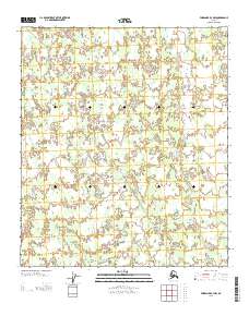
2013 Map of Fairbanks B-4 NW
USGS Topo · Published 2013About this map
The Totatlanika River meanders across this interior landscape within the Yukon-Koyukuk region, defining a drainage system that includes Fish Cr. The terrain is characterized by the presence of a Sled Rd, a specific type of seasonal transportation corridor common in Alaska, which cuts diagonally across the township lines of T 5 S and T 6 S. The map documents a sparsely developed area where the natural water systems and rudimentary trails are the primary features of the land. The absence of traditional permanent infrastructure highlights the reliance on seasonal routes for transit between more established settlements outside this quadrangle.
Find a feature on this map
5 named features on this map. Tap any name to fly to it.
Don’t see what you’re looking for? This feature index may not catch every label — zoom into the map to look around manually.
Map Details
Editions of this 2013 Fairbanks B-4 NW Map
This is the sole edition of this map. No revisions or reprints were ever made.
Other maps of this area

1949 · Fairbanks B-5
USGS Topo · 1:63,360

1949 · Fairbanks B-4
USGS Topo · 1:63,360

1950 · Fairbanks
USGS Topo · 1:250,000

1950 · Fairbanks C-5
USGS Topo · 1:63,360

1950 · Fairbanks C-4
USGS Topo · 1:63,360

1950 · Fairbanks B-5
USGS Topo · 1:63,360

1951 · Fairbanks B-5
USGS Topo · 1:63,360

1951 · Fairbanks
USGS Topo · 1:250,000

1952 · Fairbanks C-4
USGS Topo · 1:63,360
1952 · Fairbanks B-4
USGS Topo · 1:63,360