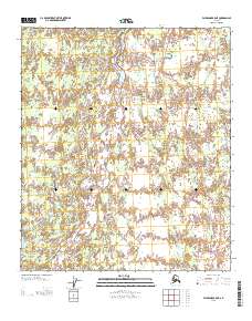
2013 Map of Fairbanks B-5 NE
USGS Topo · Published 2013About this map
Shores Landing and the curiously named Squaw Pants Crossing mark this interior Alaska landscape where the hydrological network dictates the geography. The terrain is defined by a complex system of waterways, including the winding Seventeenmile Slough and Lost Slough, which branch off larger river systems. These wetlands and creek beds, such as Julius Creek and Glacier Cr, create a mosaic of sub-arctic terrain that historically influenced movement and settlement patterns in the Yukon-Koyukuk region.
Find a feature on this map
14 named features on this map. Tap any name to fly to it.
Don’t see what you’re looking for? This feature index may not catch every label — zoom into the map to look around manually.
Map Details
Editions of this 2013 Fairbanks B-5 NE Map
This is the sole edition of this map. No revisions or reprints were ever made.
Other maps of this area

1949 · Fairbanks B-5
USGS Topo · 1:63,360

1949 · Fairbanks B-4
USGS Topo · 1:63,360

1950 · Fairbanks
USGS Topo · 1:250,000

1950 · Fairbanks C-5
USGS Topo · 1:63,360

1950 · Fairbanks C-4
USGS Topo · 1:63,360

1950 · Fairbanks B-5
USGS Topo · 1:63,360

1951 · Fairbanks B-5
USGS Topo · 1:63,360

1951 · Fairbanks
USGS Topo · 1:250,000

1952 · Fairbanks C-4
USGS Topo · 1:63,360
1952 · Fairbanks B-4
USGS Topo · 1:63,360