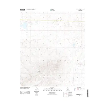
2013 Map of Fairbanks B-6 SW
USGS Topo · Published 2013About this map
Totek Hills dominates the southern half of this landscape, rising above a vast network of wetlands and seasonal ponds. Located along the boundary shared by Yukon-Koyukuk and Denali, the terrain represents a transition from high ridges to the lowland drainage systems of the interior. A distinct Sled Rd winds through the eastern portion of the sheet, providing a primary overland link through the subarctic wilderness. Water features are concentrated in the north and east, including the uniquely shaped Comma Lake, illustrating the complex hydrology of the region's permafrost-influenced basins.
Find a feature on this map
4 named features on this map. Tap any name to fly to it.
Don’t see what you’re looking for? This feature index may not catch every label — zoom into the map to look around manually.
Map Details
Editions of this 2013 Fairbanks B-6 SW Map
This is the sole edition of this map. No revisions or reprints were ever made.
Other maps of this area

1948 · Kantishna River
USGS Topo · 1:250,000

1950 · Fairbanks
USGS Topo · 1:250,000

1951 · Kantishna River
USGS Topo · 1:250,000

1951 · Fairbanks
USGS Topo · 1:250,000

1952 · Fairbanks A-6
USGS Topo · 1:63,360

1952 · Kantishna River A-1
USGS Topo · 1:63,360

1952 · Kantishna River
USGS Topo · 1:250,000

1952 · Kantishna River B-1
USGS Topo · 1:63,360

1952 · Fairbanks
USGS Topo · 1:250,000
1953 · Fairbanks B-6
USGS Topo · 1:63,360