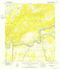
1952 Map of Fairbanks C-4
USGS Topo · Published 1952About this map
The Tanana River and its complex braided channels dominate this mid-century interior Alaska landscape, reflecting a territory in transition during the early Cold War era. South of the river, the expansive Ladd Air Force Base footprint includes a designated Bombing and Gunnery Range, established within a marked Military Reservation Boundary. This presence underscores the region's strategic importance during the 1950s.
Find a feature on this map
12 named features on this map. Tap any name to fly to it.
Don’t see what you’re looking for? This feature index may not catch every label — zoom into the map to look around manually.
Map Details
Editions of this 1952 Fairbanks C-4 Map
2 editions found

Other maps of this area

1949 · Fairbanks B-5
USGS Topo · 1:63,360

1949 · Fairbanks D-3
USGS Topo · 1:63,360

1949 · Fairbanks D-4
USGS Topo · 1:63,360

1949 · Fairbanks B-4
USGS Topo · 1:63,360

1949 · Fairbanks B-3
USGS Topo · 1:63,360

1950 · Fairbanks
USGS Topo · 1:250,000

1950 · Fairbanks C-3
USGS Topo · 1:63,360

1950 · Fairbanks C-5
USGS Topo · 1:63,360

1950 · Fairbanks C-4
USGS Topo · 1:63,360

1950 · Fairbanks D-5
USGS Topo · 1:63,360