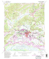
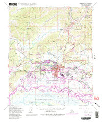
1954 Map of Fairbanks D-2
USGS Topo · Published 1995About this map
The Chena River and Tanana River converge in this mid-century portrait of interior Alaska, capturing the rapid expansion of Fairbanks and its surrounding communities. The map highlights the city's strategic role as a transportation and military hub, from the Alaska Railroad and Fairbanks International Airport to the sprawling Fort Wainwright complex. Purple revision tints reveal the growth of neighborhoods like Lemeta, Statesville, and Aurora Garden on Garden Island. To the west, the University of Alaska sits overlooking the valley, while the northern reaches show the industrial and logistical infrastructure of the Steese Highway and the Trans-Alaska Pipeline. Traditional mining and agricultural roots are still visible in the gold mine labels and the vast Creamers Field State Migratory Waterfowl Refuge, offering a detailed view of the region's transition from a frontier town to a modern arctic center.
Find a feature on this map
113 named features on this map. Tap any name to fly to it.
Don’t see what you’re looking for? This feature index may not catch every label — zoom into the map to look around manually.
Map Details
Editions of this 1954 Fairbanks D-2 Map
5 editions found
Other maps of this area

1945 · Livengood
USGS Topo · 1:250,000

1949 · Fairbanks D-1
USGS Topo · 1:62,500

1949 · Fairbanks D-2
USGS Topo · 1:62,500

1949 · Fairbanks C-1
USGS Topo · 1:63,360

1949 · Fairbanks D-3
USGS Topo · 1:63,360

1949 · Fairbanks C-2
USGS Topo · 1:63,360

1950 · Fairbanks
USGS Topo · 1:250,000

1950 · Fairbanks C-3
USGS Topo · 1:63,360

1950 · Fairbanks C-1
USGS Topo · 1:63,360

1950 · Fairbanks D-3
USGS Topo · 1:63,360