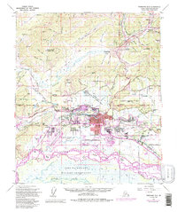
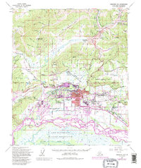
1954 Map of Fairbanks D-2
USGS Topo · Published 1995About this map
Fairbanks serves as the focal point of this mid-century survey, illustrating the significant urban and industrial footprint within the Tanana River and Chena River valley. The map documents a critical period of infrastructure development, featuring the Trans-Alaska Pipeline and the Alaska Railroad as they navigate the complex interior landscape. Aviation hubs like Fairbanks International Airport and Wainwright Army Airfield underscore the city's role as a logistical center, while the University of Alaska and nearby settlements like College and Lemeta indicate growing residential and educational corridors.
Find a feature on this map
105 named features on this map. Tap any name to fly to it.
Don’t see what you’re looking for? This feature index may not catch every label — zoom into the map to look around manually.
Map Details
Editions of this 1954 Fairbanks D-2 Map
5 editions found
Other maps of this area

1945 · Livengood
USGS Topo · 1:250,000

1949 · Fairbanks D-1
USGS Topo · 1:62,500

1949 · Fairbanks D-2
USGS Topo · 1:62,500

1949 · Fairbanks C-1
USGS Topo · 1:63,360

1949 · Fairbanks D-3
USGS Topo · 1:63,360

1949 · Fairbanks C-2
USGS Topo · 1:63,360

1950 · Fairbanks
USGS Topo · 1:250,000

1950 · Fairbanks C-3
USGS Topo · 1:63,360

1950 · Fairbanks C-1
USGS Topo · 1:63,360

1950 · Fairbanks D-3
USGS Topo · 1:63,360