
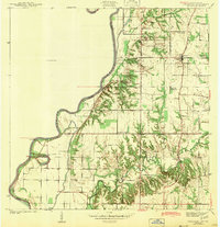
1942 Map of Fairbanks
USGS Topo · Published 1942About this map
The Wabash River serves as the dominant geographical boundary in this early 1940s survey, marking the serpentine divide between Indiana and Illinois. Along its banks, transportation history is preserved through labels like York Ferry and the York Cutoff, reflecting a time when river crossings were vital nodes of local transit. The township of Fairbanks sits at a crossroads of the Harrison Trail and Trotman Road, surrounded by a dense network of family cemeteries including Pogue Cem and Riggs Cem. This landscape is particularly notable for its intersection of early American settlement and ancient history, evidenced by multiple Indian Mounds and an Indian Mound situated near Long Pond. Cultural life is anchored by several rural congregations, such as Missionary Baptist Ch and Kingsley Memorial Ch, while the southern reaches follow the winding path of Turman Creek and its associated features like Dodds Bridge.
Find a feature on this map
28 named features on this map. Tap any name to fly to it.
Don’t see what you’re looking for? This feature index may not catch every label — zoom into the map to look around manually.
Map Details
Editions of this 1942 Fairbanks Map
2 editions found
Other maps of this area

1932 · Marshall
USGS Topo · 1:62,500

1937 · Marshall
USGS Topo · 1:62,500

1940 · Pimento
USGS Topo · 1:24,000

1942 · Shelburn
USGS Topo · 1:24,000

1942 · Hutton
USGS Topo · 1:24,000

1943 · Merom
USGS Topo · 1:24,000

1943 · Sullivan
USGS Topo · 1:24,000

1952 · Fairbanks
USGS Topo · 1:24,000

1952 · Shelburn
USGS Topo · 1:24,000
1952 · Hutton
USGS Topo · 1:24,000