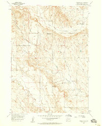
1957 Map of Fairburn SW
USGS Topo · Published 1958About this map
Cottonwood Creek and its many branching tributaries define this corner of Custer County during a period of transition for rural educational infrastructure. The landscape is characterized by the convergence of several major drainages, including Lame Johnny Creek and the South Fork French Creek, which carve through the varied topography. A significant information-gain insight is found in the status of the local educational system: by the late 1950s, the small country schools that once served this ranching country had been vacated. The map marks the locations of the South Fork Sch, Cottonwood Sch, and Hill View Sch, all noted as abandoned. These sites remain as vital coordinates for genealogists and local historians tracing the settlement patterns and community centers of the mid-twentieth century.
Find a feature on this map
6 named features on this map. Tap any name to fly to it.
Don’t see what you’re looking for? This feature index may not catch every label — zoom into the map to look around manually.
Map Details
Editions of this 1957 Fairburn SW Map
2 editions found
Other maps of this area

1894 · Hermosa
USGS Topo · 1:125,000

1896 · Oelrichs
USGS Topo · 1:125,000

1900 · Oelrichs
USGS Topo · 1:125,000

1901 · Hermosa
USGS Topo · 1:125,000

1950 · Buffalo Gap
USGS Topo · 1:24,000

1951 · Fairburn SE
USGS Topo · 1:24,000

1951 · Smithwick NE
USGS Topo · 1:24,000

1951 · Smithwick NW
USGS Topo · 1:24,000

1955 · Hot Springs
USGS Topo · 1:250,000
1957 · Fairburn NE
USGS Topo · 1:24,000