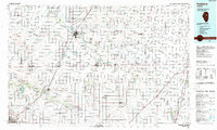
1985 Map of Fairbury
USGS Topo · Published 1989About this map
The Vermilion River and its numerous tributaries, including Rooks Creek and the South Fork Vermilion River, define the drainage of this central Illinois landscape. In the mid-1980s, the region's character was firmly established by its dense network of small agricultural settlements and a significant rail-to-road infrastructure. The city of Pontiac serves as a major focal point, notable for the presence of the Pontiac Correctional Center and its position at the intersection of historic U S 66 and Interstate 55.
Find a feature on this map
157 named features on this map. Tap any name to fly to it.
Don’t see what you’re looking for? This feature index may not catch every label — zoom into the map to look around manually.
Map Details
Editions of this 1985 Fairbury Map
2 editions found
Other maps of this area

1922 · Kankakee
USGS Topo · 1:62,500

1923 · Herscher
USGS Topo · 1:62,500

1924 · Kankakee
USGS Topo · 1:62,500

1924 · Paxton
USGS Topo · 1:62,500

1925 · Herscher
USGS Topo · 1:62,500

1925 · Streator
USGS Topo · 1:62,500

1926 · Normal
USGS Topo · 1:62,500

1927 · Paxton
USGS Topo · 1:62,500

1927 · Streator
USGS Topo · 1:62,500

1927 · Danvers
USGS Topo · 1:62,500