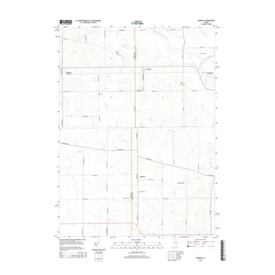
2015 Map of Fairdale
USGS Topo · Published 2015About this map
Fairdale and Esmond anchor this northern Illinois landscape, sitting along the border between Ogle and DeKalb counties. The agricultural character of the region is defined by a rigid grid of rural roads like Old State Rd and Base Line Rd, which cut across the meandering paths of the South Branch Kishwaukee River and its tributaries, including Bessie Cr and Kingsbury Cr. Small community hubs are marked by local landmarks like Vodden Airport and a series of historical burial grounds including Roseland Cem, Porter Cem, and the uniquely named Hick's Mill Cem.
Find a feature on this map
46 named features on this map. Tap any name to fly to it.
Don’t see what you’re looking for? This feature index may not catch every label — zoom into the map to look around manually.
Map Details
Editions of this 2015 Fairdale Map
This is the sole edition of this map. No revisions or reprints were ever made.
Other maps of this area

1917 · Kings
USGS Topo · 1:62,500

1918 · Kings
USGS Topo · 1:62,500

1918 · Kirkland
USGS Topo · 1:62,500

1934 · De Kalb
USGS Topo · 1:62,500

1937 · De Kalb
USGS Topo · 1:62,500

1949 · Camp Grant
USGS Topo · 1:24,000

1952 · Rochelle
USGS Topo · 1:62,500

1954 · Rockford
USGS Topo · 1:250,000

1955 · Rockford
USGS Topo · 1:250,000

1958 · Aurora
USGS Topo · 1:250,000