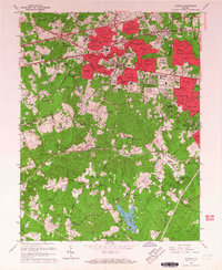
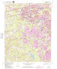
1966 Map of Fairfax
USGS Topo · Published 1967About this map
Fairfax City and its surrounding suburbs emerge amidst a rapidly densifying landscape in this mid-1960s record. The city center is anchored by the Fairfax Co Courthouse, Library, and City Hall, while residential growth is evidenced by numerous developments like Lord Fairfax Estates, Mantua, and Mosby Woods Park. This period marks the early development of George Mason College and the establishment of major recreational hubs such as Burke Lake County Park and the Army Navy Country Club.
Find a feature on this map
154 named features on this map. Tap any name to fly to it.
Don’t see what you’re looking for? This feature index may not catch every label — zoom into the map to look around manually.
Map Details
Editions of this 1966 Fairfax Map
5 editions found
Other maps of this area

1890 · Mt. Vernon
USGS Topo · 1:125,000

1891 · Mt. Vernon
USGS Topo · 1:125,000

1894 · Mt. Vernon
USGS Topo · 1:125,000

1897 · Mt. Vernon
USGS Topo · 1:125,000

1900 · Washington
USGS Topo · 1:62,500

1913 · Indian Head
USGS Topo · 1:62,500

1915 · Fairfax
USGS Topo · 1:62,500

1923 · Indian Head
USGS Topo · 1:48,000

1925 · Indian Head
USGS Topo · 1:62,500

1927 · Quantico
USGS Topo · 1:62,500