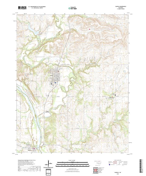
2022 Map of Fairfax
USGS Topo · Published 2022About this map
Fairfax serves as the central hub for this portion of the northern Oklahoma plains, where the Arkansas River forms a significant boundary between Osage and Pawnee counties. The settlement pattern reveals a landscape rooted in the late 19th-century tribal history of the Osage Nation, particularly evident in the presence of the Greyhorse Indian Village Cem near the community of Gray Horse. The terrain is defined by its watercourses, with the meandering Salt Creek flowing toward the river and Wild Cr feeding into Fairfax City Lake to the north. Transportation corridors like Co RD 6925 and the railroad-influenced point at Osage Junction reflect the region's historical reliance on transit between agricultural and river centers. Further south, the town of Ralston anchors the bottom of the sheet, situated along the northern bank of the river opposite the intersection of several county roads.
Find a feature on this map
62 named features on this map. Tap any name to fly to it.
Don’t see what you’re looking for? This feature index may not catch every label — zoom into the map to look around manually.
Map Details
Editions of this 2022 Fairfax Map
This is the sole edition of this map. No revisions or reprints were ever made.
Other maps of this area

1929 · Skedee
USGS Topo · 1:62,500

1930 · Pawnee
USGS Topo · 1:62,500

1931 · Skedee
USGS Topo · 1:62,500

1932 · Fairfax
USGS Topo · 1:62,500

1936 · Belford
USGS Topo · 1:62,500

1936 · Pawnee
USGS Topo · 1:62,500

1955 · Enid
USGS Topo · 1:250,000

1958 · Enid
USGS Topo · 1:250,000

1964 · Charley Creek NE
USGS Topo · 1:24,000
1978 · Burbank
USGS Topo · 1:24,000