1951 Map of Fairfield
USGS Topo · Published 1977About this map
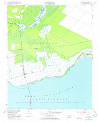
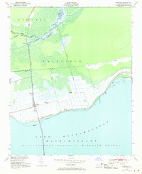
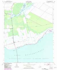
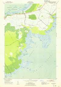
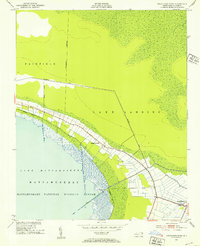
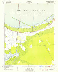
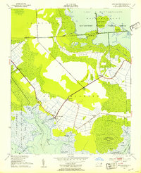
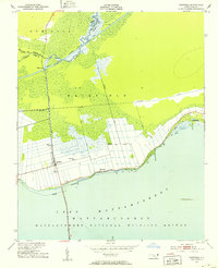
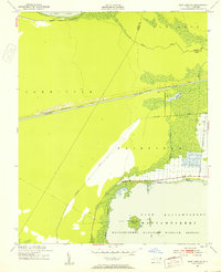
The low-lying coastal plains of Hyde County meet the northern shore of Lake Mattamuskeet in this mid-century survey of the Fairfield area. The landscape is defined by a dense network of drainage canals and the Mattamuskeet National Wildlife Refuge boundary, which skirts the water's edge. To the north, the Intracoastal Waterway follows the Alligator River, connected to the agricultural interior by the Pungo River Canal and the Fairfield Bridge. Small rural centers such as Carmur and the community surrounding Star Zion Ch and Bethlehem Ch are positioned along the primary roads leading toward the lake. The presence of Ruins east of Carmur and the extensive canal system reflect a region deeply shaped by large-scale land reclamation efforts and the maritime commerce of the Alligator River basin.
Find a feature on this map
17 named features on this map. Tap any name to fly to it.
Don’t see what you’re looking for? This feature index may not catch every label — zoom into the map to look around manually.
Map Details
Editions of this 1951 Fairfield Map
4 editions found
Other maps of this area

1943 · Columbia
USGS Topo · 1:125,000
1951 · Middletown
USGS Topo · 1:24,000
1951 · Engelhard West
USGS Topo · 1:24,000
1951 · New Holland
USGS Topo · 1:24,000
1951 · Swanquarter
USGS Topo · 1:24,000
1951 · Fairfield
USGS Topo · 1:24,000
1951 · New Lake SE
USGS Topo · 1:24,000
1953 · Fairfield NE
USGS Topo · 1:24,000

1953 · Fairfield NW
USGS Topo · 1:24,000

1953 · Rocky Mount
USGS Topo · 1:250,000