
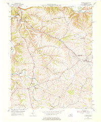
1953 Map of Fairfield
USGS Topo · Published 1955About this map
Fairfield sits near the eastern edge of this landscape where the Salt River carves through the northern hills of Nelson County. The settlement patterns of the early 1950s are defined by small crossroads and water-driven geography, with Highgrove and Coxs Creek serving as secondary hubs. Social life is centered around local institutions such as Little Union Ch and Riverview Ch, while the Highgrove Sch and Cox Creek Sch provide evidence of rural school districts still tied to their immediate communities.
Find a feature on this map
27 named features on this map. Tap any name to fly to it.
Don’t see what you’re looking for? This feature index may not catch every label — zoom into the map to look around manually.
Map Details
Editions of this 1953 Fairfield Map
2 editions found
Other maps of this area

1907 · Louisville
USGS Topo · 1:62,500

1929 · Taylorsville
USGS Topo · 1:62,500

1949 · Cravens
USGS Topo · 1:24,000

1949 · Samuels
USGS Topo · 1:24,000

1949 · Shepherdsville
USGS Topo · 1:62,500

1951 · Waterford
USGS Topo · 1:24,000

1951 · Mount Washington
USGS Topo · 1:24,000
1951 · Louisville
USGS Topo · 1:62,500

1953 · Maud
USGS Topo · 1:24,000

1953 · Bardstown
USGS Topo · 1:24,000