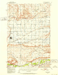
1950 Map of Fairfield
USGS Topo · Published 1952About this map
Irrigation infrastructure and agricultural planning define the Teton County landscape following the mid-century development of the Missouri River Basin project. The town of Fairfield serves as a central hub for this network, flanked by the Fairfield Airstrip and an extensive grid of numbered roads such as North First Road and South Second Road. The map reveals a complex water delivery system essential for farming on the high plains, including the Greenfield Main Canal, Great Northern Ditch, and Fort Shaw Canal.
Find a feature on this map
35 named features on this map. Tap any name to fly to it.
Don’t see what you’re looking for? This feature index may not catch every label — zoom into the map to look around manually.
Map Details
Editions of this 1950 Fairfield Map
4 editions found
Other maps of this area

1886 · Great Falls
USGS Topo · 1:250,000

1920 · Choteau
USGS Topo · 1:125,000

1943 · Hogan
USGS Topo · 1:125,000

1949 · Cascade
USGS Topo · 1:62,500

1949 · Vaughn
USGS Topo · 1:62,500

1950 · Fairfield
USGS Topo · 1:62,500

1950 · Dutton
USGS Topo · 1:62,500

1950 · Collins
USGS Topo · 1:62,500

1951 · Cascade
USGS Topo · 1:62,500

1952 · Vaughn
USGS Topo · 1:62,500