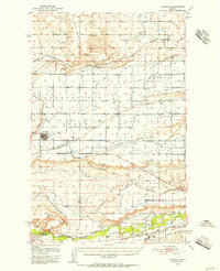
1950 Map of Fairfield
USGS Topo · Published 1956About this map
The irrigation-driven landscape of the Missouri River Basin project is clearly visible in this 1950s survey. The town of Fairfield serves as the central hub for a vast network of water engineering, including the Greenfield Main Canal and Greenfield South Canal, which transform the high plains into productive land. To the south, the Sun River meanders through the valley, passing the site of Fort Shaw and the Old Fort Shaw Cem (Historic), providing a window into the region's 19th-century military history. Transport routes are well-defined, showing the competing rail lines of the Great Northern and the Chicago Milwaukee St Paul and Pacific. The contrast between the flat Bole Bench and the southern coulees, such as Blackfoot Coulee and Mill Coulee, illustrates the distinct transition from the plateau to the river bottomlands.
Find a feature on this map
34 named features on this map. Tap any name to fly to it.
Don’t see what you’re looking for? This feature index may not catch every label — zoom into the map to look around manually.
Map Details
Editions of this 1950 Fairfield Map
4 editions found
Other maps of this area

1886 · Great Falls
USGS Topo · 1:250,000

1920 · Choteau
USGS Topo · 1:125,000

1943 · Hogan
USGS Topo · 1:125,000

1949 · Cascade
USGS Topo · 1:62,500

1949 · Vaughn
USGS Topo · 1:62,500

1950 · Fairfield
USGS Topo · 1:62,500

1950 · Dutton
USGS Topo · 1:62,500

1950 · Collins
USGS Topo · 1:62,500

1951 · Cascade
USGS Topo · 1:62,500

1952 · Vaughn
USGS Topo · 1:62,500