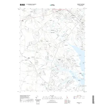
2019 Map of Fairmount
USGS Topo · Published 2019About this map
The eastern edge of the Delmarva Peninsula reveals a complex network of wetlands and tidal inlets as they appeared in 2019. The landscape is defined by the branching waters of Herring Creek and Guinea Creek, which carve into the terrain to create distinct landforms like Pine Water Neck and Angola Neck. This survey documents a mix of long-established crossroads and newer residential developments. Local history is anchored by sites such as Indian Mission and Goslee Mill, while the presence of several cemeteries—including Saint Georges Cem and Ebenezer Cem—provides vital points of interest for genealogical research. The map also shows the transition from the marshy edges of Rehoboth Bay to inland settlements like Fairmount and Hollymount, illustrating how the coastal geography has dictated the pattern of roads and communities in this part of Sussex County.
Find a feature on this map
227 named features on this map. Tap any name to fly to it.
Don’t see what you’re looking for? This feature index may not catch every label — zoom into the map to look around manually.
Map Details
Editions of this 2019 Fairmount Map
This is the sole edition of this map. No revisions or reprints were ever made.
Other maps of this area

1917 · Millsboro
USGS Topo · 1:62,500

1918 · Cedar Creek
USGS Topo · 1:62,500

1918 · Rehoboth
USGS Topo · 1:62,500

1918 · Cape Henlopen
USGS Topo · 1:62,500

1919 · Cedar Creek
USGS Topo · 1:62,500

1937 · Cape Henlopen
USGS Topo · 1:62,500

1938 · Cedar Creek
USGS Topo · 1:62,500

1938 · Millsboro
USGS Topo · 1:62,500

1938 · Rehoboth
USGS Topo · 1:62,500

1943 · Fairmount
USGS Topo · 1:24,000