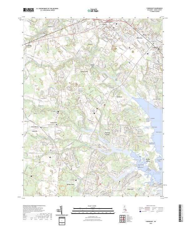
2023 Map of Fairmount
USGS Topo · Published 2023About this map
Goslee Mill and its associated Goslee Mill Pond stand as central landmarks in this coastal Sussex County landscape, where the labyrinthine waterways of the Delmarva Peninsula meet the western reaches of Rehoboth Bay. The area is characterized by a dense network of residential communities and historic ecclesiastical sites, including Indian Mission and the Israel United Methodist Church. Family history is deeply etched into the land through numerous small burial grounds such as the Baker Family Cem and the Henry Lingo Farm Cem. To the east, the transition from mainland to tidal marsh is marked by features like Wolfpit Marsh and Angola Neck, while the Georgetown-Lewes Trl provides a modern corridor through established settlements like Pinetown and Five Points.
Find a feature on this map
79 named features on this map. Tap any name to fly to it.
Don’t see what you’re looking for? This feature index may not catch every label — zoom into the map to look around manually.
Map Details
Editions of this 2023 Fairmount Map
This is the sole edition of this map. No revisions or reprints were ever made.
Other maps of this area

1917 · Millsboro
USGS Topo · 1:62,500

1918 · Cedar Creek
USGS Topo · 1:62,500

1918 · Rehoboth
USGS Topo · 1:62,500

1918 · Cape Henlopen
USGS Topo · 1:62,500

1919 · Cedar Creek
USGS Topo · 1:62,500

1937 · Cape Henlopen
USGS Topo · 1:62,500

1938 · Cedar Creek
USGS Topo · 1:62,500

1938 · Millsboro
USGS Topo · 1:62,500

1938 · Rehoboth
USGS Topo · 1:62,500

1943 · Fairmount
USGS Topo · 1:24,000