
1902 Map of Fairoaks
USGS Topo · Published 1902About this map
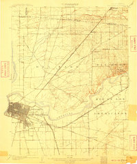
The city of Sacramento and the historic grant of New Helvetia define this early twentieth-century landscape, showing the capital's expansion just as its street grid met the surrounding agricultural lands. The American River snakes through the center of the sheet, acting as both a geographic barrier and a corridor for development. To the east, the settlement at Fairoaks is established near the river bluffs, while the Southern Pacific R. R. (Ogden Line) drives a diagonal path through Arcade and Antelope toward Roseville. This era represents a pivotal moment when overland travel was transitioning from historic stage stops like Twelvemile House on the Auburn Road to a sophisticated rail network. Further south, the map captures the burgeoning suburban clusters of Oak Park and Highland Park, along with rural outposts like Walsh Station and Perkins along the Southern Pacific R. R. (Niles and Livermore Line).
Find a feature on this map
40 named features on this map. Tap any name to fly to it.
Don’t see what you’re looking for? This feature index may not catch every label — zoom into the map to look around manually.
Map Details
Editions of this 1902 Fairoaks Map
2 editions found
Other maps of this area

1891 · Sacramento
USGS Topo · 1:125,000

1892 · Sacramento
USGS Topo · 1:125,000

1893 · Sacramento
USGS Topo · 1:125,000

1894 · Lodi
USGS Topo · 1:125,000

1907 · Davisville
USGS Topo · 1:62,500

1908 · Courtland
USGS Topo · 1:62,500

1908 · Buffalo Creek
USGS Topo · 1:31,680

1909 · Elk Grove
USGS Topo · 1:31,680

1909 · Cosumnes
USGS Topo · 1:31,680

1909 · Florin
USGS Topo · 1:31,680