
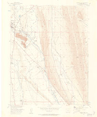
1956 Map of Fairplay East
USGS Topo · Published 1957About this map
Fairplay and its surrounding ranchlands are documented here just after the mid-century, revealing a landscape defined by hydraulic engineering and early mining footprints. The Middle Fork South Platte River winds through the center of the sheet, flanked by a complex system of water management features including the Alkaline Ditch, Miller-Chapman Ditch, and several Aqueducts. These irrigation works supported numerous family operations such as the Coil Ranch, Buyer Ranch, and Platte Ranch. The high-altitude terrain is anchored by the prominent Red Hill and Reinecker Ridge to the east. Visible evidence of the area's industrial past includes an Old Railroad Grade and massive Tailings piles near the town site, reflecting the residue of large-scale placer mining that reshaped the valley floor long before this 1956 survey.
Find a feature on this map
30 named features on this map. Tap any name to fly to it.
Don’t see what you’re looking for? This feature index may not catch every label — zoom into the map to look around manually.
Map Details
Editions of this 1956 Fairplay East Map
3 editions found
Other maps of this area

1889 · Leadville
USGS Topo · 1:125,000

1891 · Leadville
USGS Topo · 1:125,000

1934 · Climax
USGS Topo · 1:48,000

1937 · Como
USGS Topo · 1:62,500

1938 · Mt. Lincoln
USGS Topo · 1:48,000

1942 · Leadville
USGS Topo · 1:125,000

1945 · Mount Lincoln
USGS Topo · 1:62,500

1953 · Denver
USGS Topo · 1:250,000

1956 · Elkhorn
USGS Topo · 1:24,000

1956 · Garo
USGS Topo · 1:24,000