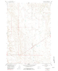
1959 Map of Fairpoint SE
USGS Topo · Published 1983About this map
Elm Creek meanders through this section of Meade County, defining the primary drainage pattern of this South Dakota landscape. The terrain is characterized by the expansive Cross area, where the elevation changes are subtle but significant for local land use. While predominantly rural, the presence of a Gravel Pit indicates localized resource extraction near the sectional roads. This survey, based on 1958 aerial photography, provides a detailed look at the section lines and topography before the turn of the century, serving as a clean record of the open ranching or farming country in the western part of the state.
Find a feature on this map
4 named features on this map. Tap any name to fly to it.
Don’t see what you’re looking for? This feature index may not catch every label — zoom into the map to look around manually.
Map Details
Editions of this 1959 Fairpoint SE Map
2 editions found
Other maps of this area

1953 · Hereford
USGS Topo · 1:24,000

1953 · Hereford NE
USGS Topo · 1:24,000

1953 · Rapid City
USGS Topo · 1:250,000

1954 · Haydraw
USGS Topo · 1:24,000

1957 · Rapid City
USGS Topo · 1:250,000

1959 · Fairpoint
USGS Topo · 1:24,000

1959 · Fairpoint SW
USGS Topo · 1:24,000

1959 · Stoneville
USGS Topo · 1:24,000

1959 · Union Center
USGS Topo · 1:24,000

1959 · Fairpoint NW
USGS Topo · 1:24,000