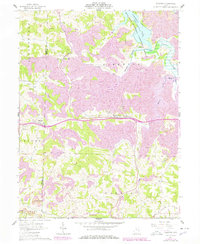
1961 Map of Fairview
USGS Topo · Published 1978About this map
Hendrysburg and Fairview anchor this portion of the eastern Ohio landscape, where the rugged topography of the Muskingum Watershed Conservancy District meets the industrial reality of coal country. The map captures a detailed view of extractive land use, with numerous Strip Mine and Strip Mines operations marking the ridges and valleys between Sewellsville and Cabinet. This era of development is defined by the transition from rural agricultural routes to the high-speed infrastructure of Route 70, which cuts through the center of the sheet near Hope Cem. To the north, the waters of Piedmont Lake fill the valley of Stillwater Creek, while the southern reaches show the Baltimore and Ohio railroad corridor near Olivet. Genealogists will find several family and community landmarks, including Fairview Cem, Gibson Cem, and the rural Salem Ch.
Find a feature on this map
40 named features on this map. Tap any name to fly to it.
Don’t see what you’re looking for? This feature index may not catch every label — zoom into the map to look around manually.
Map Details
Editions of this 1961 Fairview Map
3 editions found
Other maps of this area

1903 · Flushing
USGS Topo · 1:62,500

1905 · Woodsfield
USGS Topo · 1:62,500

1905 · Flushing
USGS Topo · 1:62,500

1909 · Antrim
USGS Topo · 1:48,000

1909 · Summerfield
USGS Topo · 1:62,500

1911 · Antrim
USGS Topo · 1:62,500

1911 · Summerfield
USGS Topo · 1:62,500

1949 · Clarksburg
USGS Topo · 1:250,000

1951 · Canton
USGS Topo · 1:250,000

1953 · Canton
USGS Topo · 1:250,000