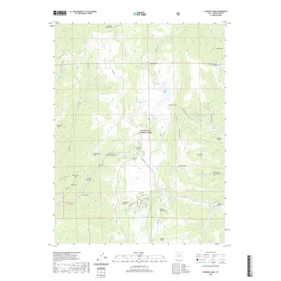
2020 Map of Fairview Lakes
USGS Topo · Published 2020About this map
The high-elevation watersheds of the Wasatch Plateau define this section of the Manti-La Sal National Forest during the 2020s. Centered on the scenic Fairview Lakes, the landscape is a network of ridges and drainage forks, including Cottonwood Canyon and Gooseberry Creek. This survey details the complex water management infrastructure of the era, notably the Narrows Tunnel near Fairview Canyon and the Beaver Dam Reservoir. The transportation network is dominated by Skyline Dr, which traces the crest of the plateau, providing access to summer recreation areas and forest service routes like Brooks Canyon Rd and the Oak Creek & Stock Trl. From the heights of Pine Crown Peak to the basin of Boulger Reservoir, the map illustrates a modern era of forest management and alpine residency.
Find a feature on this map
55 named features on this map. Tap any name to fly to it.
Don’t see what you’re looking for? This feature index may not catch every label — zoom into the map to look around manually.
Map Details
Editions of this 2020 Fairview Lakes Map
This is the sole edition of this map. No revisions or reprints were ever made.
Other maps of this area

1885 · Manti
USGS Topo · 1:250,000

1895 · Manti
USGS Topo · 1:250,000

1923 · Scofield
USGS Topo · 1:62,500

1925 · Scofield
USGS Topo · 1:62,500

1939 · Soldier Summit
USGS Topo · 1:62,500

1942 · Soldier Summit
USGS Topo · 1:62,500

1956 · Price
USGS Topo · 1:250,000

1960 · Price
USGS Topo · 1:250,000

1962 · Price
USGS Topo · 1:250,000

1965 · Huntington Reservoir
USGS Topo · 1:24,000