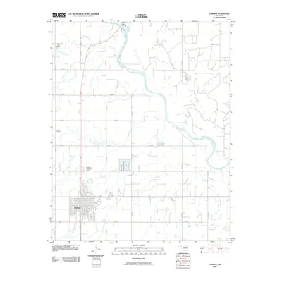
2009 Map of Fairview
USGS Topo · Published 2009About this map
The Cimarron River winds through this Major County landscape, defining the hydrology and drainage patterns of the region north of Fairview. At the beginning of the 21st century, the grid-based development of the area is evident in the extensive section-line road system, including e0490 RD and n2560 RD, which provides access to the agricultural lands and homesteads. The town of Fairview itself occupies the southwestern corner, characterized by a traditional street grid and proximity to the Fairview Municipal Airport.
Find a feature on this map
28 named features on this map. Tap any name to fly to it.
Don’t see what you’re looking for? This feature index may not catch every label — zoom into the map to look around manually.
Map Details
Editions of this 2009 Fairview Map
This is the sole edition of this map. No revisions or reprints were ever made.
Other maps of this area

1955 · Woodward
USGS Topo · 1:250,000

1958 · Woodward
USGS Topo · 1:250,000

1969 · Fairview NE
USGS Topo · 1:24,000

1969 · Glass Mountains
USGS Topo · 1:24,000

1969 · Fairview SE
USGS Topo · 1:24,000

1969 · Fairview
USGS Topo · 1:24,000

1969 · Cleo Springs
USGS Topo · 1:24,000

1969 · Glass Mountains NE
USGS Topo · 1:24,000

1972 · Longdale
USGS Topo · 1:24,000

1972 · Homestead
USGS Topo · 1:24,000